
Here’s the latest Hurricane Sandy the “Frankenstorm” news, Save Jerseyans, from the Governor’s office and the Office of Emergency Management.
FYI- Save Jersey is merely conveying news to you as we hear/read it from official sources; all residents should primarly rely on www.ready.gov for the most current information:
- According to an Administration release, Governor Chris Christie has “authorized the closure of all State Offices for Monday, October 29, 2012 due to the impending impact of Hurricane Sandy and dangerous weather conditions.”
- Governor Chris Christie has already asked President Barack Obama for a declaration of a “pre-landfall emergency” for New Jersey, allowing the state to request additional emergency federal funds for its preparations.
- The Atlantic City Casinos will close by 4:00 P.M. today, and Barrier Islands (Sandy Hook and south) have been ordered to evacuate by 4:00 p.m. TODAY as well. Beginning this afternoon and into the evening, certain roads including the A.C. Expressway will only be accessible via westbound lanes. To confirm the latest closures, motorists should check for current road conditions at the New Jersey Department of Transportation website — www.NJ511.info.
- NJ TRANSIT will shutdown of all services beginning at 4:00 p.m. this afternoon. Check njtransit.com or call (973) 275-5555 for updates.
- PATH service is offline beginning Midnight Sunday. Check www.panynj.gov for updates.
- The New Jersey Judiciary has closed all court buildings for Monday, October 29th. Some Shore county vicinages are closed Tuesday, too. Check www.judiciary.state.nj.us for more info.
- Motor Vehicle Commission (MVC) agencies, inspection stations and driver testing centers are closed on Monday, October 29th.
- Again, all New Jerseyans should tab/bookmark www.ready.gov for official updates, alerts and preparedness-related tips as this weather event develops.
- The National Guard has been deployed. According to Brig. Gen. Michael L. Cunniff, the Adjutant General of New Jersey, “[t]he New Jersey National Guard has prepared an aggressive joint – Army and Air – plan in anticipation of the need for a military first response.”
And where is Sandy right now? What’s the latest re: its track?
From WPVI-ABC (Philly):
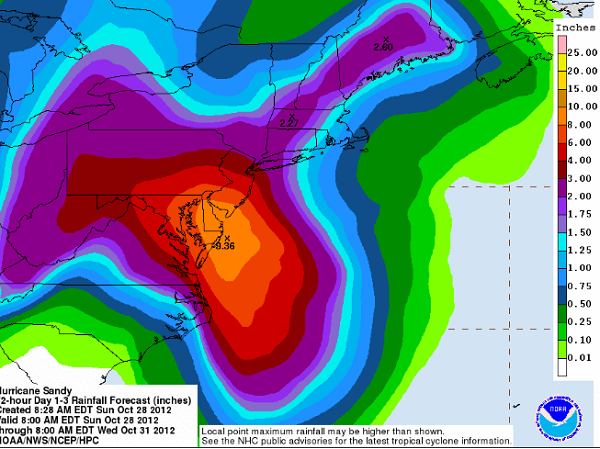
The latest “most likely” track for Hurricane Sandy has shifted slightly south along the Jersey Coast late Sunday morning with a Monday night or early Tuesday morning landfall now projected to a bit south of Atlantic City. This would potentially mean a greater storm surge farther south along the coast and closer to our local beaches. The track could change again, but this latest adjustment does not bode well for coastal communities. Also, the winds associated with the storm are growing on forecast models and widening. This could mean that a larger portion of the area could see the strongest winds; gusts over 80 mph are not out of the question in the hardest hit areas.” [Emphasis Added]
I’ll continue to keep you informed as best I can for as long as power allows…


