Prepare yourselves:
—
Maybe it’s not quite THAT dire, Save Jerseyans, and we all know that meteorology isn’t the world’s most reliable science, but there’s a decent chance that your Tuesday schedule could be seriously disrupted.
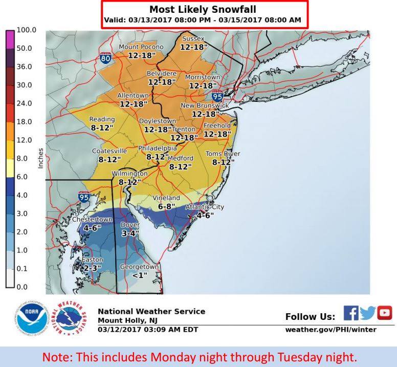
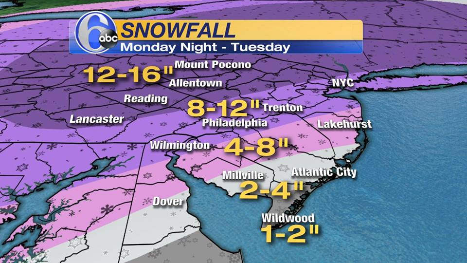
All popular models are currently forecasting a significant snowfall for most New Jersey (and the entire Mid-Atlantic region) beginning Monday night and continuing on throughout most of Tuesday; here in the glorious Garden State, we’ve got a bulls-eye on our backs as snow total predictions presently range as low as a trace amount for Cape May County to 18 inches (or more!) for the Delaware Water Gap.
High winds, beach erosion and yes, school closings are all looking far more likely than not.
Want advice on how to best prepare? It’s snow (not exactly complicated), but the info over at the New Jersey Office of Emergency Management is useful all the same.
Here’s the latest from the National Weather Service and ABC-6 out of Philadelphia:
—
—
_____